

An article on PrecisionAg.com describes how Mast Farms LLC, a family-owned multi-generational farm that raises cotton in east Mississippi, is using the AeroVironment Quantix Mapper drone to collect timely and accurate data on when and where to apply Pix on their cotton fields.
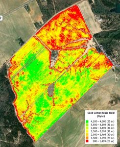
After capturing the images, the Mast Farms team processes them with Pix4Dfields to generate NDVI maps and create zonation maps.
“It’s not any cheaper than using fixed-wing imagery, but it gives us independence to get the job done in the fastest way possible,” says Lowell Mullet, Member Manager, Mast Farms LLC.
You can find more details – including a slideshow – in the article “Applying Pix in Cotton with Quantix Mapper Drone and Pix4Dfields.”


Leave a Reply